ABOUT · ONE PERSON · NEW RIVER VALLEY
Built by one person
Built by one person
in the New River Valley.
StormCast is a side project that grew into something useful. Here's how it got here.
THE STORY
I live in Giles County, Virginia, in the New River Valley.
When Hurricane Helene came through in September 2024, the flooding hit western North Carolina hard and reached us here too. Figuring out what was actually happening meant jumping between multiple sources.
I wanted one app that did all of it — weather alerts, river levels, and hurricanes on a single screen. So I built it.
StormCast runs on free, official public weather data — the same information you'd check yourself, stitched into one place you can read at a glance. There's no company behind it; it's my time and my hosting bill.
A LOOK INSIDE
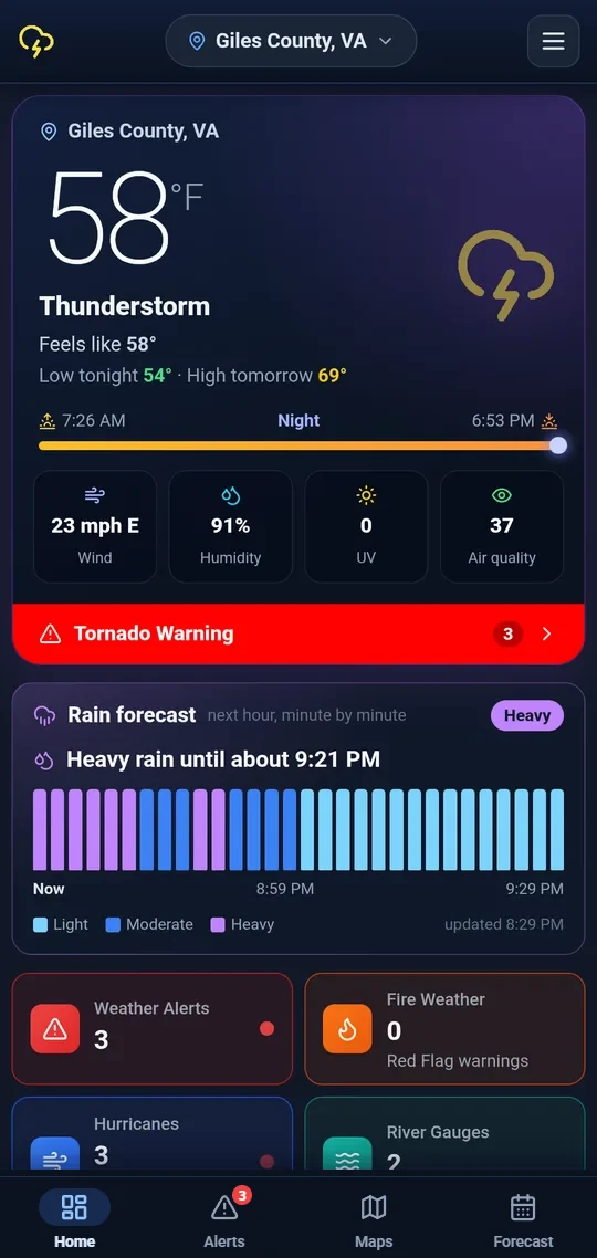
Your weather and any warnings, first thing.
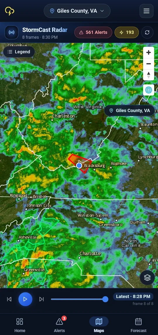
Radar with the warning drawn right on the map.
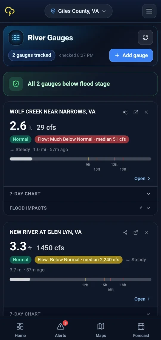
The rivers and creeks you care about.
What it looks like on your phone.
THE ROAD SO FAR
From itch to app.
Sep 2024 · Spark
Hurricane Helene
The flooding in western North Carolina, and here at home in Giles County, made me want one app for weather alerts, river levels, and hurricanes.
Q4 2024 · Prototype
First build on my own phone
A scrappy Android prototype with weather alerts and one local river gauge.
Q1 2025 · Public beta
First APK released to friends and neighbors
Sideload-only, no Play Store.
Q3 2025 · Notifications
Push notifications & flood-stage alerts
Push notifications, and river gauges with official flood levels.
2026 · Now
National coverage
Multi-location monitoring, nationwide coverage, faster alerts, refreshed dashboard. Live on Google Play and actively shipping every few weeks.
Coming · 2026 — 2027
iOS & what's next
An iPhone version, custom alert zones, and a few other ideas in the roadmap below.
ROADMAP
What I'm working on next.
UP NEXT
No date set
iOS version
An iPhone build with the same alert engine and dashboard. Join the waitlist to be notified when it ships.
UP NEXT
Q4 2026
Custom alert zones
Draw your own watch areas on the map — a school district, a hiking trail, a friend's farm — and get alerts only for what matters to you.
EXPLORING
2027
Wear OS & Apple Watch
Silent vibration alerts on your wrist for severe warnings, with a quick-glance dashboard tile.
LIVE
Shipped · Q1 2026
Multi-location monitoring
Track home, work, family — get alerts for every saved area, not just where you are right now.
LIVE
Shipped · Q4 2025
Persistent temperature notification
Always-on temperature and conditions in your status bar. Updates silently in the background.
GET IN TOUCH
Got feedback? Send it over.
Bug reports, feature ideas, things that aren't working.
Contact & support
— Stay safe out there.